Yummy Spiced Chicken Wings

Here’s a Yummy Chicken WiNGs recipe

that I picked up from a BBQ Sauce recipe site.

Ingredients:

1.4 chicken wings
3 cloves garlic, minced
1/4 cup olive oil
1 tablespoon butter
1 tablespoon crushed red pepper flakes
2 tablespoons lemon juice

Seasoning for chicken wings

adobo seasoning (tumeric and salt)
black pepper
Accent seasoning (seasoned salt)

Method

Preheat over to 180 degrees C (350F).

Rinse the chicken wings in cool water, then place them on a foil covered baking tray.

Sprinkle chicken wings with the Adobe, pepper and seasoned salt. Place chicken under the griller, and grill on both sides until browned.

Whilst you’re waiting, heat olive oil and butter in a small frypan. When butter is melted, add the red pepper flakes and garlic.

Continue cooking over medium/low heat for about 5 minutes.

Just before the garlic starts to brown, turn heat off and add the lemon juice. Once chicken is brown on both sides, pour this sauce over the chicken wings, and bake for 20 minutes at 180 degrees C (350 degrees F).

Once again, if you’re looking for some more BBQ sauce recipes, then click on the linked text

Maps, Maps and More Maps (Apologies to the Mats, Mats People!)

outback maps, maps of the outback, Australia mapsIt’s no secret that I LOVE maps.

I probably should have been a cartographer (except I suck at maths … but I’m pretty good with GIS).

I’ve got a HUGE collection of maps.

The other day, I would trawling through my collection and I came across my favourite creased, dog-eared and travel-stained map: an old copy of Hema’s Simpson Desert map:

The mere sight of this creased, much-loved outback map‘s front cover brings back so many memories.

Like my very first field trip into the desert, where I pulled up on the side of a dune for lunch, boiled my billy and then called my mother on the sat phone.

When I told her where I was, she freaked out. As if I was making one last, desperate phone call to say goodbye!

I didn’t have the heart to tell her I was a hundred metres from a very good track that’s well traversed by tourists and locals!

Another memory is the incredible joint management project I worked on to protect sacred Waddywood Trees at the Mac Clarke Conservation Reserve (which is on the Simpson Desert’s western edge).

This was a project to fence all 3000 of these very rare trees, which was assisted by Park rangers, Aboriginal people, local pastoralists and conservation volunteers.

It involved 41 km of fencing materials!

It also marks the occasion when I became bogged in mud in the Simpson Desert. Twice in 10 metres!!

Thank goodness there was another car there to snatch us out, otherwise it would have been a very, long, cold night….

My Favourite OUtback Map?

This is a bit of a tough question. I love topographic maps, but there’s also lots of Hema maps that I love, too.

But without doubt, my most favourite of all outback maps are the Pink Roadhouse mud maps.

The Pink Roadhouse is in Oodnadatta, run by Adam and Lynne Plate. They make the most gorgeous, hand drawn mud maps.

Australian Outback mapsThese maps have been invaluable in all our forays along the Oodnadatta Track and into the Simpson Desert.

I love the quirky text and the great little localised tid-bits of information that Adam & Lynne provide.

Have you got a favourite Australian outback map? Have you ever used one of the Pink Roadhouse’s maps?

Fabulous Lake Eyre Flight and Video

Lake Eyre flightI’m having a bit of Lake Eyre over kill right now.

That’s because another friend has just come back from the lake.

She stayed at Marree (which she thought was a really creepy place!), and took a Lake Eyre scenic flight from the airstrip there.

I guess the difference to the flight that we did is that you’d fly up from the south and right over the Lake South. I think some flights go over Marree Man (or what’s left of him!).

Anyway, I was looking at Lake Eyre clips on You Tube and found this short clip from Channel 10 that someone had posted.

If you’re not sure what all the fuss is about for Lake Eyre, then take a look that this clip:

Seeing that makes me want to go back down there before all the water evaporates. I’d love to do another flight over Lake Eyre again.

This time, I’d take only video. Oh well….

Everything You Wanted Know About Personal Locator Beacons (But Were Too Shy to Ask!)

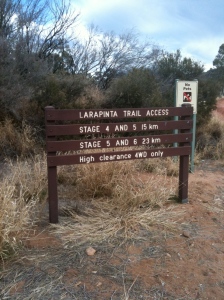
personal locator beaconI’m about to go out and do some solo hiking along the Larapinta Trail.

Actually, I’m hoping it stops raining and warms up enough to let me go, because right now, it’s FREEZING in Central Australia.

As I’m by myself (yes, that’s right: a woman, walking alone on the Trail), one of the things I’ll be taking with me is a Personal Locator Beacon.

Personal Locator Beacons or PLBs are little life saving devices that all walkers, outback visitors and hikers should have.

How a PLB Works

I’ll let you know that I had a vague idea how a PLB worked:

bypersonal locator beacon broadcasting a signal to a satellite which let authorities know where you were.

A couple of weeks ago, the people who monitor the PLB alerts (the Australian Maritime Safety Authority) were here in Alice Springs. They were able to fill in some of the details for me – and alert me to the fact that it’s not a perfect service!

When turned on, the PLB broadcasts a signal that is picked up by satellites orbiting the Earth.

This signal is then relayed to the Australian Maritime Safety Authority (AMSA) thru a ground station who will contact the most relevant authorities to help in any search and recovery.

Sometimes, this signal is weak and difficult to get a fix on. More on this later.

The people who are monitoring often have to wait until the satellite makes another pass over the area. This can take up to 45 minutes.

Once an approximate location has been determined, the relevant authorities are called in.

For walkers like me,  in the Outback, this will  be rangers on foot or NT Emergency Services via helicopter.

The rangers or chopper go to the coordinates the personal locator beacon broadcasts ( or uses radio direction finding to home in on the beacon ). More often than not, this will be an approximate location.

They can then search for the walker and rescue them.

Types of Personal Locator BEacons

This is where is gets really interesting and I have to tell you, I learned a lot! I’d always thought that PLBs were pretty much the same. However, that’s not the case.
personal locator beacon

I discovered that there are 2 differing types. Your successful rescue (in the case of an emergency) could depend upon you selecting the right PLB:

  • One type simply broadcasts a signal
  • The other sends a signal AND your GPS co-ordinates

Remember how I told you above that getting an accurate position on a PLB signal can be difficult?

The first kind of PLB (the one that only sends a signal) means that the authorities will take the longer to figure out just where the signal is coming from.

This is because at least 2 passes overhead by the satellite are required to identify the location.

The PLB with the GPS fitted provides a nearly immediate set of co-oordinates which will enable a rescue to be kicked off immediately.
personal locator beacon with GPS

So if you’re truly in difficulty or have life-threatening issues I know which one I might select.

Trust me, the marginally higher cost of GPS-enabled PLB could be the honest to goodness difference between life and death. I know which one I’d rather have!

TIPS FOR USING A PERSONAL LOCATOR BEACON

It’s very important to remember that a PLB is a final resort.

Your primary emergency should be by phone, radio or other direct communication if available. Direct communication will always end up in a quicker and more acceptable reply as you’ll be able to talk with emergency services.

Only utilize a PLB if you are unable to speak straight to emergency services and important help is needed.

What do you need to know about using a PLB so you can get the best signal out?

  • Before using your PLB, move to an open area away from trees and scrub
  • Try to get up as high as possible
  • Make sure you’ve got a clear view of the maximum amount of the sky that you can get

The bad news is, there are some instances when a PLB either won’t work or you’re going to have to wait a very long time before rescue:

  • Thick cloud cover – sometimes interferes with signals
  • If you’re in a gorge or canyon – the signal just won’t get out clearly
  • Stormy weather – Lightning can make it tricky to get a precise position and delay rescue.
  • Also remember that stormy weather might delay ground crews or rescue by chopper
  • Night – Satellites will pick up the PLB signal at night, but it may be the day after before a copter or the rangers can get in to find you

So, in talking to the people at the AMSA, I’ll tell you I did indeed learn a lot.

Hopefully, I won’t need to use my PLB (it’s one of the ones WITHOUT the GPS!) when I’m off hiking over the next few days.

Lake Eyre Scenic Flights

Lake Eyre scenic flights, Lake Eyre flights, Lake EyreIn case you don’t know, Lake Eyre sits just south of the centre of Australia.

  • It’s about 700 Km – 435 miles – north of Adelaide. Australia’s roughly the size of continental USA. The total population is about 22 million.
  • Lake Eyre is one of the most inhospitable places in Australia. It’s usually waterless. It’s a vast, white salt lake, in the middle of nowhere.
  • The area that feeds the lake is huge: 3668 square miles. Texas is 2681 square miles. It’s the lowest point on the Australian continent: 49 ft or 15 metres below sea level.
  • The Lake was named after explorer Edward John Eyre, the first European to see it in 1840.
  • Lake Eyre experiences a small (1.5 m) flood every 3 years, a large (4 m) flood every 10 years and fills an average of only four times each century!

In 2009 and 2010, massive above average rains fell over Central Australia and much of the outback.

This rainfall filled all the creeks, rivers and other tributaries that flow into the lake.

It’s taken a couple of years, but Lake Eyre is now full of water…

All the streams and wetlands that feed the lake are overflowing.

Even if there’s no more rain, for a long time, water will continue to flow into it for months to come.

Central Australia, usually dry, barren, brown and now arid is green and verdant.

Vegetation, dormant for decades is abundant and flowering. Bird, animal and even marine life has reappeared as if from nowhere.

Lake Eyre has only filled a handful of times in the past hundred years.

Right now, tour companies are falling over themselves to get you to visit and take a Lake Eyre Scenic flight.

Because there’s so many of these companies doing business, now is a great time to grab a bargain.

In other words, if you’re wondering whether you should you go, and whether you’ll be able to afford it, you’re in a prime position to negotiate the best price on a flight that you possibly can – before the water dries up for another 20 years.

If you’re thinking about a special trip you’ll remember for the rest of your life, take a Lake Eyre scenic flight before the water dries up. This is something to tell your grandkids about!

And remember: the rain has stopped falling – you’ll wait another 20 years to see this again.

Lake Eyre: 3 Reasons You Should GO NOW!

In outback Australia, there’s a giant salt lake known as Lake Eyre.

This lake is found in outback South Australia, roughly 670 kilometres north east of Adelaide, and about two hundred kilometres east of the underground mining town of Coober Pedy.

Lake Eyre flights, lake eyre scenic flights, lake eyre

The lake is one of the most inhospitable places in Australia.

It’s an enormous dry salt pan, that glitters blinding white under the sun.

Very few things live or grow on the lake.

But several times each century, something incredible occurs.

Following huge rains in Queensland, it fills with water and bursts to life. In 2011, Lake Eyre has filled up following record rains in Queensland and the Northern Territory.

When that occurs, pelicans and other waterbirds fly inland in their many thousands and set up great breeding colonies on the lake. Fish also breed in the lake, and the birds feed off these fish.

To go to Lake Eyre usually, you’ll usually need a 4WD and experience in off-road, remote area driving.

The alternative is to take a Lake Eyre Flight.

Flights over the lake became hugely popular over the past 2 years ( 2010-2011 ) as the lake filled with water and burst to life

You can take short, 1-2 hour Lake Eyre flight from William Creek (known for it’s great outback bar ), from Marree (where the famous Birdsville and Oodnadatta Tracks begin ) or from Coober Pedy.

Lake Eyre Scenic flights start from as little as $250 per head from William Creek, through Wrights Air.

A flight over the lake will let you take some fantastic photographs, and you may see plenty of the big bird breeding colonies. And, if you are into photography or birdwatching, then a flight over the lake is particularly for you. As we’ve related above, Lake Eyre changes color from pink to blue to green – all in a matter of moments.

You can see all these dazzling changes in a single flight. Nonetheless the lake will not have water in it for keeps. As the rains have slowed, the water will vaporize in 2012.

We reckon you must take a flight over the lake sometime in 2011 to see the lake at its best.

This doesn’t mean you can’t take a flight over the lake when it’s dry.

Lake Eyre flights will be available at William Creek and Marree all of the time.

It basically means the lake will not have water in it if you intend to go later.

Without or with water, we suggest that you visit Australia’s biggest lake, Lake Eyre, and take a scenic flight over this phenomenal outback wonder.

Uluru – The Healing Rock

Uluru – The Healing Rock

Author: Mats Loefkvist

During my mission of finding Aboriginal secrets in Australia I had the honor of meeting one of the guardians of the famous Ayers Rock or Uluru, which is the Aboriginal name.

David, who was my half aboriginal guide, took me for a car ride around Alice Springs, looking for an old man who was going with us on our trip to Ayers Rock. We drove to the big parks, looking among the many groups of aborigines just sitting around.

Paid to sit.

I could not understand why all these people were doing nothing. It looked like they were waiting for something, but what?

David told me that the government prefers to give them food and money for alcohol to keep them quite, rather than finding meaningful jobs and tasks for them to do. This was a shocking statement for a European who is used to a well organized social care system.

The journey to the rock.

The old man was found at his home, sleeping on his fold away bed. Quickly he collected a few personal belongings and rolled them into his bed. His equipment was put on the back of the truck and off we went, heading for Uluru.

The old man was very friendly and spoke a broken English. David explained that this aboriginal man was chosen by the elders to be the guardian of Uluru and all his life he was thought the secrets of the rock.

Spiritual disrespect.

Ayers Rock is known worldwide and regarded as one of the most popular tourist attractions in Australia. Busses are lined up at the base of the rock and visiting tourists are walking up and down the whole day long.

We started a slow walk around Uluru, giving the old man an opportunity to explain what the rock means to the Aboriginal people.

I was told that Uluru is the most important spiritual place for the indigenous people and only a few times a year, on certain dates, they are allowed to climb the rock to perform their ceremonies. This is the way it has been done for many thousand years.

With no respect for their spiritual values, the white man turned their most sacred place into a tourist attraction.

The change of color.

After our walk I looked at all the people still marching up and down, not having a clue about what they were doing.

We drove about a mile away from the rock to watch it from the distance during the sunset. The rock turned into the most amazing red color that I ever saw. At the same time as we gazed at this spectacular scene, our Aboriginal guardian chanted the story of Uluru in his native language.

The spiritual cave

I was planning to stay overnight at one of the nearby hotels and I offered my friends to join me. This was not what they were used to and obviously they did not feel very comfortable with the idea.

We all ended up sleeping in a parking lot on the ground.

The next morning was planned for a very special occasion. We were going to see the sunrise from a spiritual cave at Ayers Rock. During the time we walked around the rock, it was not obvious that any cave existed, which made me curious about where we were going.

Only initiated Aboriginal men were allowed to enter the cave that was impossible to spot, if you did not know where it was. For some reason, the guardian of Uluru made an exception to the rule and let me enter the cave together with him.

The old man was chanting about the story of the cave, while we were watching the sun rise. I felt a deep honor and respect for this ancient culture and I could not believe how blessed I was to have this experience.

The healing rock.

The Aborigines talks about the healing of the earth and the human races that will take place. Patiently they are waiting for the day when people will respect them and listen to the knowledge and wisdom they always had.

Uluru is their sacred place for earth healing and receiving of spiritual insights, which it should be respected for.

The final message from the old Aboriginal man was:

The white man is advanced in technology but starved and ignorant in spiritual knowledge and not yet ready to learn.

Article Source: http://www.articlesbase.com/alternative-medicine-articles/uluru-the-healing-rock-2423950.html

About the Author

Get more articles like this in our FREE Newsletter about alternative medicine and life changing ideas.

Looking forward to continue talking to you.

Mats Loefkvist

http://www.alternative-healing.ws/newsletter.htm

Ayers Rock’s Aboriginal Name: 5 Things you probably don’t know

Ayers Rock’s Aboriginal Name: What does it mean?

There are five things that the average person probably doesn’t know about Ayers Rock’s Aboriginal name.

Uluru, which is also popularly known as Ayers Rock, is the rock’s Aboriginal name.

Ayers Rock is located in the south of the Australian outback, in the Northern Territory. Consisting of a massive reddish-to-brown coloured rock formation mainly of sandstone, this ancient natural wonder is iconic to Australia and it classified as a World Heritage Site.

Ayers Rock is readily accessible to visitors and tourists, even if it lies 460 kilometres south west of the closest major town, Alice Springs, which is a vibrant tourist hot spot. Today the Uluru-Kata Tjuta National Park is a popular Australian tourist destination that features Kata Tjuta and Uluru. 

1. WHO COINED THE NAME ‘ULURU?’
The origin of the Ayers Rock aboriginal name is attributed to the Yankunytjatjara, an aboriginal culture whose territory covers the Ayer Rock’s location.

In addition, ‘Uluru’ (Aboriginal pronunciation: [uluɻu]) is a Yankunytjatjara word. Uluru, aside from referring to the country where Ayers Rock stands, is also the designation for the area where a specific Yankunytjatjara sub-group or estate group resides.

Although most of the rest of Australia refer to this great rock formation by the Ayers Rock aboriginal name, Uluru, the local community of the Yankunytjatjara and Pitjantjatjara people today call Ayers Rock by the term ‘Uluru’. The word is said to have no specific meaning in the Pitjantjatjara language but the people also regard it as a native family last name of the elderly Traditional Owners of Uluru.

 2. TWO NAMES ONE ROCK

The famous Australian landmark officially became known as Ayers Rock on July 19, 1873 courtesy of William Gosse—a surveyor who named the huge sandstone formation after Sir Henry Ayers, who was the incumbent Chief Secretary of South Australia during that time.

Although most people identify the landmark with its Anglicized name, the dual-naming policy—which officially recognizes two names of both English and Aboriginal origins—only came into effect on December 15, 1993 through the appellation ‘Ayers Rock/Uluru.’

This was the Northern Territory’s first attraction officially possessing a dual name. However, on November 6, 2002 the joint names were reversed to ‘Uluru/Ayers Rock’ as a result of a proposal by Alice Springs’s Regional Tourism Association.

 3. MEANING

What does ‘Uluru’ mean anyway? Here’s where the plot thickens. A lot of interpretations have sprouted all over the web, most of which only complicate the issue rather than clarify it.

Some say that the translation of ‘Uluru’ in English is ‘big rock,’ while others weave lofty denotations into the aboriginal name the likes of which are ‘rainbow dreaming’ and ‘heart chakra dreaming.’ Nothing can be farther from the truth or more ridiculous.

Other than to generally denote a place, the name has no further particular meaning.

However, the aboriginal name has several connotations in the Yankunytjatjara language that connote ‘crying/wailing,’ ‘shade’ and ‘shadows.’ According to anthropologists who are experts on aboriginal culture in the Northern Territory, several aboriginal languages in Central Australia regard the phonetic sound ‘ul’ as shadow or shade, while a few features of the south western portion of Ayers Rock have names that can be understood to mean shadows or shade.

 4.  ONE ROCK MANY PARTS

Similar to individual parts of the human body, Ayers Rock features several named places too. Rock caves, springs and water holes are examples of distinct features that the Aboriginal people gave names to. Since they considered Uluru as a sacred site, they also provided individual names to distinguish one spiritual site from the other. Tjunkurrpu, Kantju, Taputji are just some examples.

 5. OWNERS

The ‘Anangu’ (this is a word in a group of Aboriginal languages that just means ‘person’. It is NOT the name of an Aboriginal tribe!) are considered as the traditional owners of the Ayers Rock. Anangu people are in fact, Yankunytjatjara and Pitjantjatjara people.

I’ll repeat: Anangu is NOT THE NAME OF ANY ABORIGINAL “TRIBE”. IT IS A WORD THAT MEANS “PERSON” IN SEVERAL ABORIGINAL LANGUAGES.

Please help to spread the truth and email website owners who write rubbish about Aboriginal culture on their sites!

The Australian government returned ownership of Uluru to Aboriginal people on October 26, 1985 under the condition that they would lease the Uluru back to Australia’s National Parks and Wildlife Agency for 99 years jointly managed. The Ayers Rock aboriginal name means so much more to its original owners since it will always consider the Rock as a spiritual landmark.

Visiting Palm Valley

Palm Valley is an amazing outback oasis located 120 km west of Alice Springs.

It’s part of Finke Gorge National Park – and if you’re heading to Red Centre, then it’s one of those ‘must-see’ places.

Palm Valley is a famous for its groves of Red Cabbage Palms – unique to this part of the world- along with stunning gorges and cliffs.  These Palms have drawn people from all over the world both as tourists and scientists to see them.

Walking amongst them, it’s hard to believe that you’re actually in Central Australia. The tall, slender palm trunks extend up to 15 metres in the air, and are topped by a mop of cool, shiny fronds. The earth around the palms is often wet, fed by a permanent spring.

Running right through Palm Valley is the Finke River, which is supposedly the oldest river in the world (this is a misnomer: it’s the oldest river in the world that’s continually followed the same course!).

Because there’s a permanent water supply here, Palm Valley really is an oasis in the outback. There are over 400 species of plants in Finke Gorge National Park. About 30 these classed as rare, or like the Red Cabbage Palms, are found nowhere else.

Aboriginal people from the Western Aranda language group have also lived in the area for several thousand years. They call the valley Pmolankinya and the landscape is full of the tracks of Dreaming ancestors and sacred sites.

There is a great campground at Palm Valley, complete with showers, toilets and free gas BBQs. Booking isn’t necessary, and its costs only $6 per night (p.p) to stay there.

There are a number of walks in and around the valley, so an overnight trip is recommended. As well, it’s a great place for photography and birdwatching.

How to Visit:

The Park is about 140 km west of Alice Springs, and takes about 2 hours to drive there. You will definitely need a 4WD!

If you’re leaving from Alice Springs, follow Larapinta Drive for 120 km to Hermannsburg. At Hermannsburg, cross the Finke River and turn left as soon as you come up out of causeway.

It’s 20km from the turnoff into the valley itself. For most of the way, the track is actually in the bed of the Finke River.

The last 16 km of this track is quite rough. For this reason, you absolutely have to have a 4WD. After rain, the road is impassable and the Park can be closed.

If you don’t have access to a 4WD, then there are a number of tours which run out of Alice Springs that go to Palm Valley. Try Palm Valley Tours here if you’d like to take a tour.

Further information: call Finke Gorge National Park (08) 8956 7401.

Uluru for Cheapskates: How Locals Save Money Visiting Ayers Rock

Going to Ayers Rock can be very expensive. Even we locals balk at the costs.

Hotel rooms cost up to $900 per night, and all of the accommodation there is own by a single company.

Shameful as it is, lots of overseas (and Australian visitors) get totally ripped off when they Ayers Rock during your Australian vacation.

So we’ve come up with a few sneaky, dirty tricks to help us avoid the Ayers Rock robber barons. 

1. Drive, join a tour or fly?

Ths might seem like a strange tip, but believe us, it’s critical to consider this before you go. Ayers Rock is a long, long way from all of the major capital cities in Australia, just getting there can a BIG cost.

If you’re short on time, flying to Uluru could be your the best choice. If you’re willing to fly in and fly out on the same day, you’ll save 100s of dollars on hotels and car hire expenses.

Of course,  you won’t be able to climb the Rock or have much time for sightseeing… but you will get to see Ayers Rock.

2. GO in the Low Season

The best way to save money at Uluru is to avoid the peak travel season in April-October.

You can get cheap accommodation at Ayers Rock through the hotter summer months of November – March. Sometimes, it’s possible to get special discounts of up to $200 per room, per night in summer!

(DON’T FORGET: Australia’s summers are the opposite of those in the US and Europe.)

The downside of a summer trip is that it’s very hot, there’s lots of flies, and you definitely won’t be able to climb Ayers Rock if you’re planning on doing it.

The upsides of going in the summer is that if you just want to see Uluru and take photos, then you’ll be able to save 100’s of dollars.

3. How LONG TO Spend There?

As we’ve said above, you can spend one day at Uluru and see all the main sights.

But most people find that 2 or 3 nights are all they need. Really, staying for 2 nights that you’ll be able to see the main sights and still have time to kick back and relax.

Take our tip: 2 nights is all that most people need at Uluru.

4. Accommodation: The Biggest Rip Off

Now for the bad news: there is no cheap accommodation at Ayers Rock.

There are two ways to overcome this if you’re not planning on camping:

  • go in the off season
  • get a group 4 or 5 people and book a cabin in the campground ($150 per night). This might mean you pay as little as $25 per person, per night

5. Camping: The only REAL Budget option

If you really want to beat the Ayers Rock robber barons, then you really need to think about camping.

You can save serious money if you camp AND do the following things:

  • Camp in the Ayers Rock Resort campground – it’s only $20 p.p per night
  • If you don’t mind driving, you can camp for only $2 per night at Curtin Springs (80km east/50min drive from Uluru). The downside over doing this is that once you’ve spent the day at Uluru/Kata Tjuta, you’ll have to drive back Curtin Springs in the evening
  • Camp along side the road, but make sure that you’re outside of Uluru Kata Tjuta National Park. You are able to camp legally within the road reserves in the Northern Territory (within about 50 metres either side of the road), provided you’re out of the National Park, and you’re not on Aboriginal Land.

If you plan your trip to Uluru with these tips, you’ll be able to slash costs on your outback trip.

Keep in mind, however, that Uluru is situated in an extremely remote place, so transport costs add more prices of food, services and accommodation.